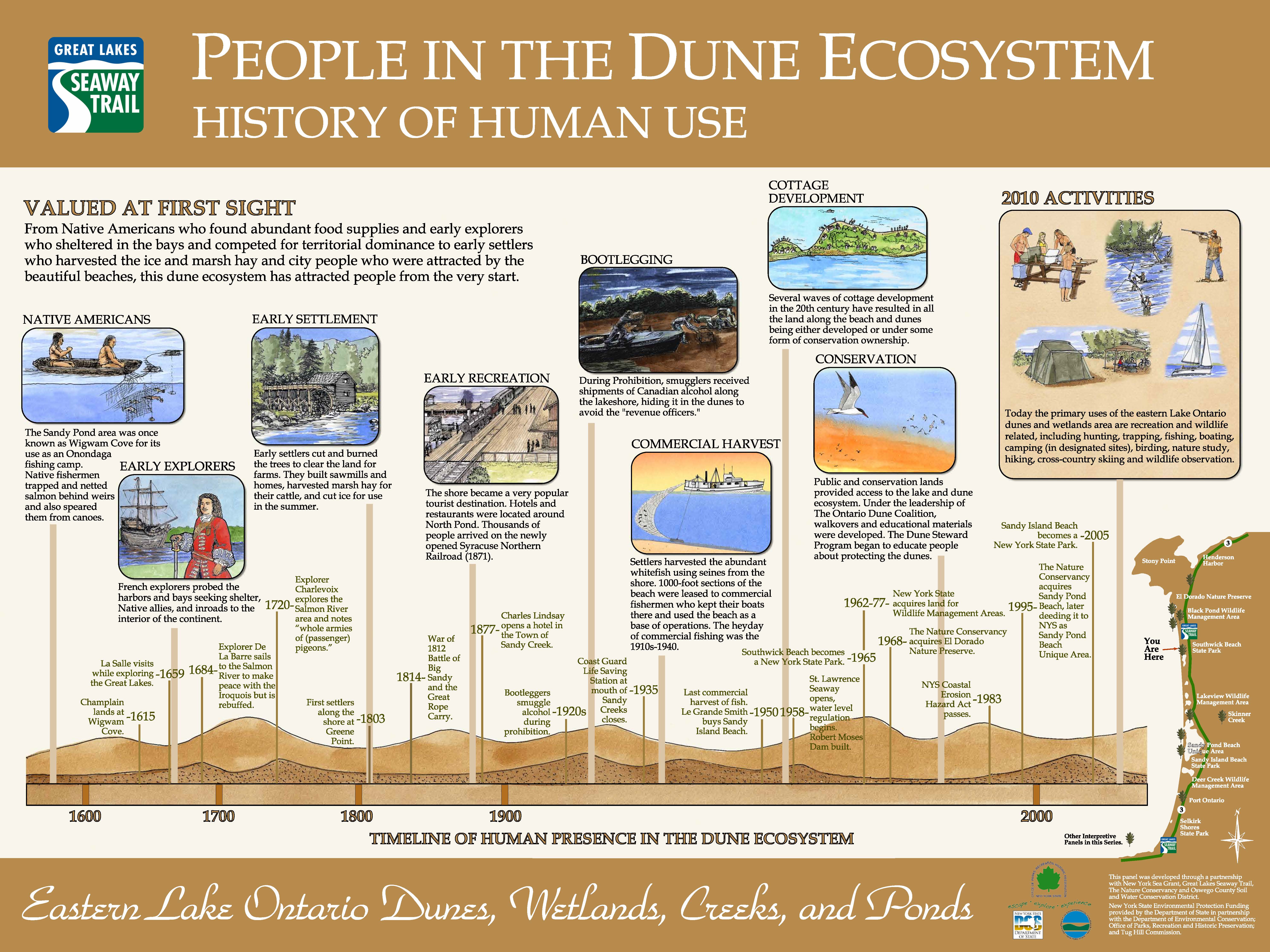
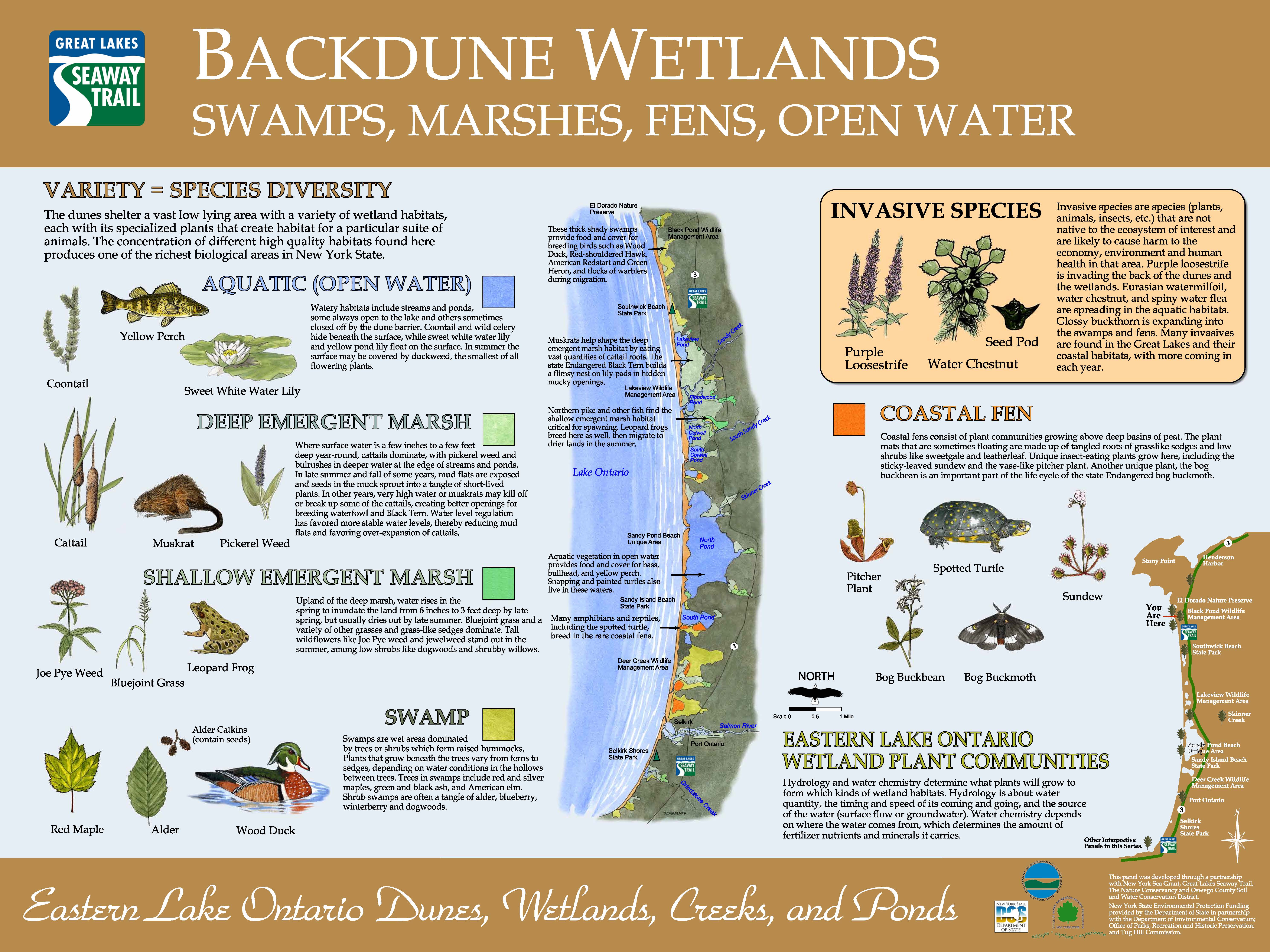
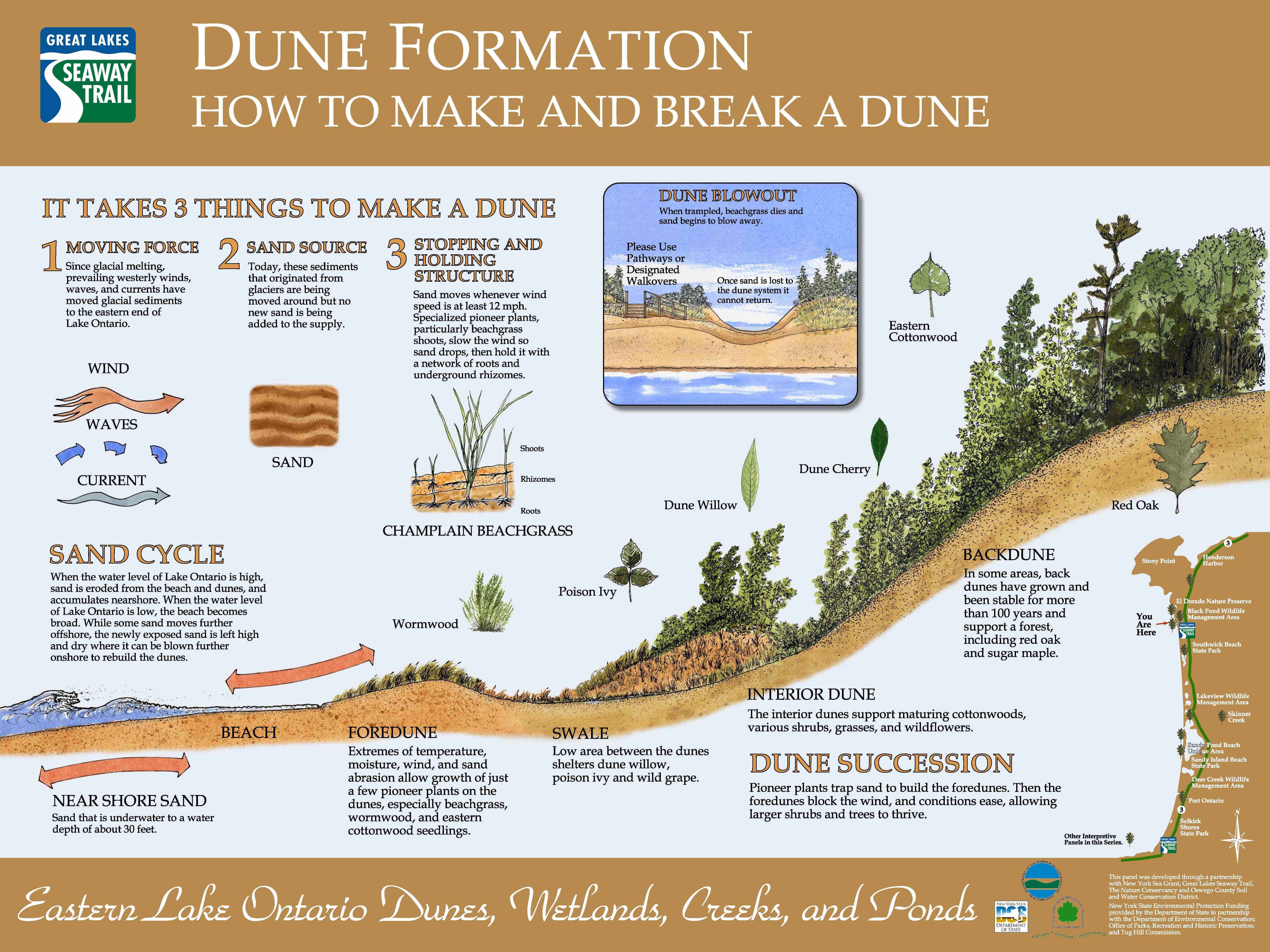
Gateway South Panel
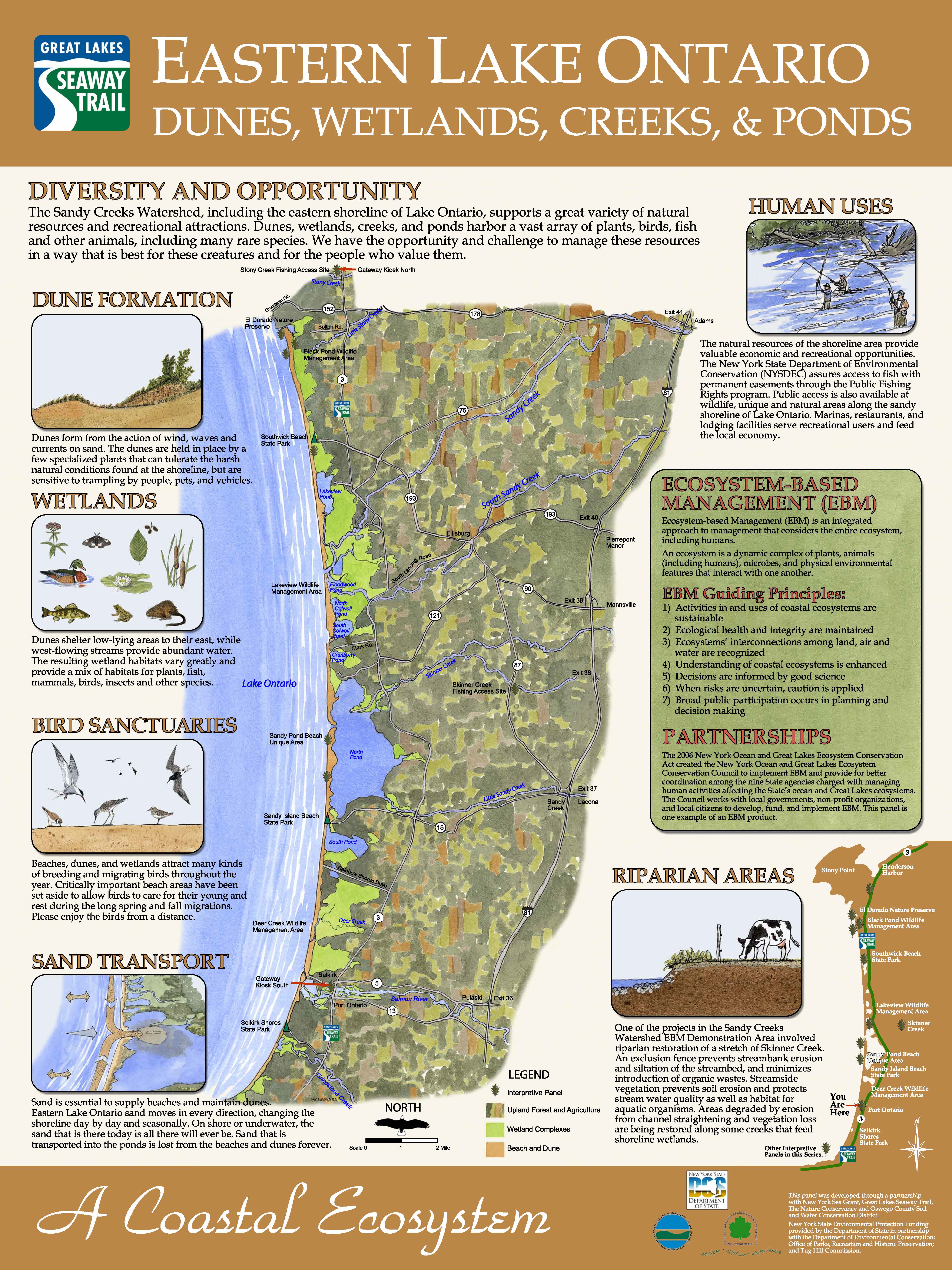
A series of 10 interpretive panels were designed and installed in the ELODWA. The panels are listed in order from the most southern located panel (Gateway South) and are in order to the most northern panel (Gateway North). Click on each panel image to download for use, the navigational map located at the bottom right of each panel can be used to find the panel location in the ecosystem.
Interpretive project partners include New York Sea Grant, Great Lakes Seaway Trail, New York State Tug Hill Commission and the New York State Department of Environmental Conservation with funds from New York State Department of State.
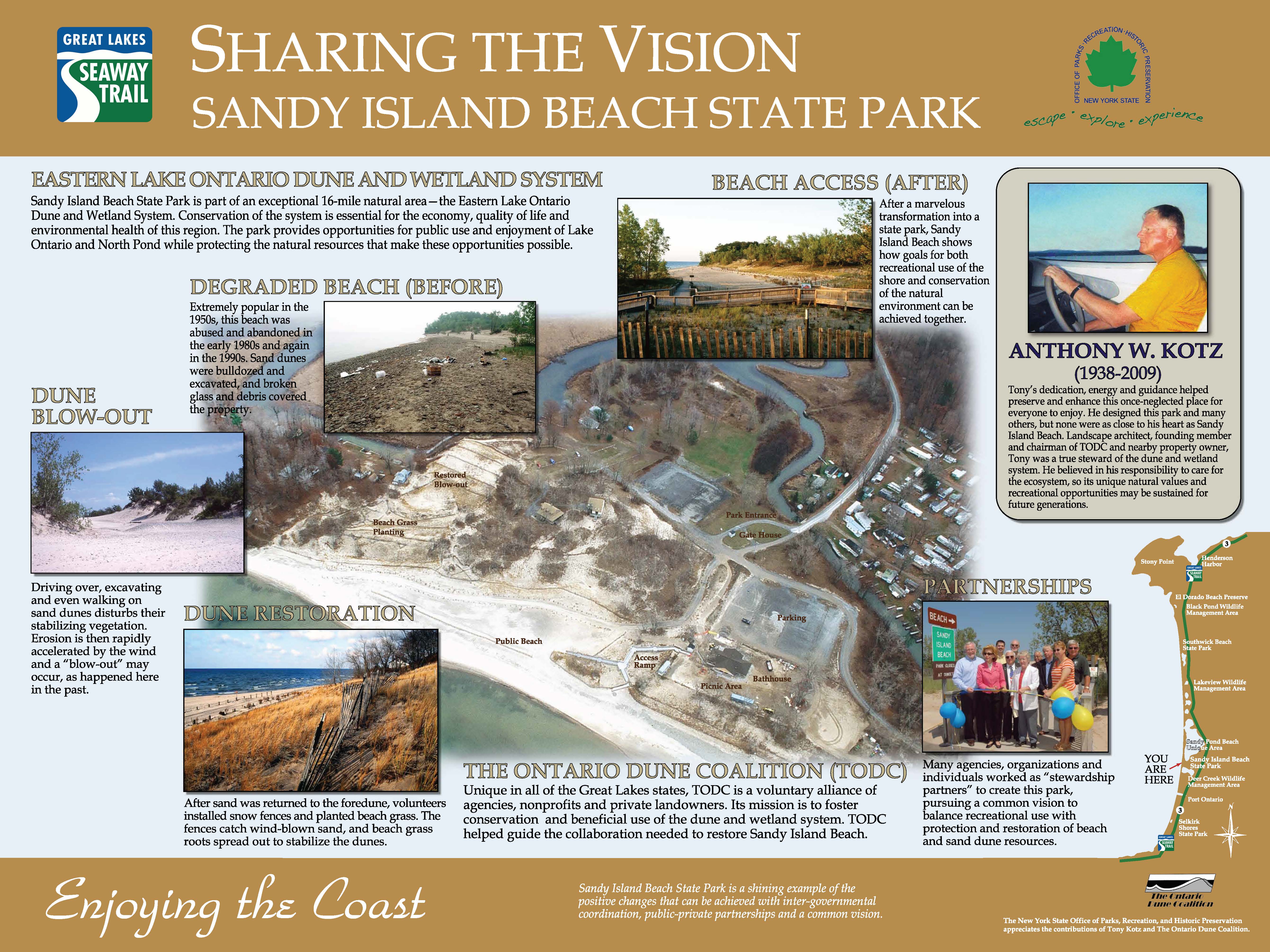
New York State Office of Parks, Recreation and Historic Preservation is hosting an interpretive panel at Sandy Island Beach State Park. This panel was developed in memory of the Eastern Lake Ontario Dune Coalition's former Chairperson, Tony Kotz. It also highlights the key to the coalition's success along ELODWA and partnerships.
.jpg)