|
|
Lake Guardian: Of Sands and Salmon
By Paul F on Aug 6, 2013 at 2:25 PM
TUESDAY, AUGUST 6, 2013
On Dry Land Again, the Educators Talk with Media and Legislators on What They'll Bring Back to the Classroom and What They've Learned about Eastern Lake Ontario's Dunes and Wetlands as well as Some of the Lake's Key Sport-fishing Species
Once the U.S. Environmental Protection Agency's (EPA) 180-foot R/V Lake Guardian docked in the Port of Oswego, its passengers were once again prepared to stretch their sea, er, lake legs. After perusing some interpretive panels provided by Great Lakes Seaway Trail, the educators on-board from all over the Great Lakes learned that the maritime history here is strong, with settlements around Oswego Harbor having begun as early as 1755. For nearly 60 years, the earliest Europeans to settle in the area were all about protecting fur trading, having built forts along the mouth of Lake Ontario to guard their strategic inland waterways, including the Oswego River. Then, for several decades beginning around 1850, products from the interior and other lake ports were transferred between canal and lake vessels. Grain, lumber and other products were stored in the harbor, waiting shipment between Canadian and U.S. markets. And, in more recent times, recreational activities, especially boating and fishing, have become the dominant focus. Many waterfront warehouses and docks have been replaced by restaurants, hotels and riverwalks. Much of area's history is well documented today at the port's H. Lee White Marine Museum.
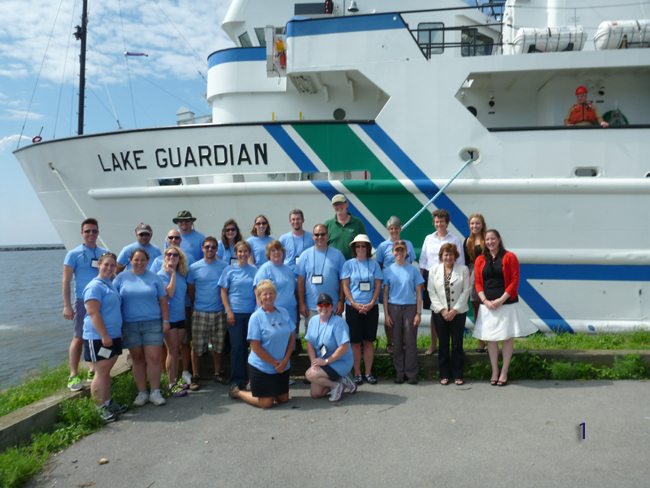
Early in the morning while at the harbor's port, the researchers, educators and crew of the R/V Lake Guardian played host to a handful of reporters and politicians during a brief meet-and-greet. Joining the group (pictured in blue and green shirts, above, [1]) were: New York Sea Grant's (NYSG) Associate Director Kathy Bunting-Howarth, NYSG Program Advisory Council member Dr. Michael Ameigh, general manager of WRVO Public Radio, and representatives from U.S. Congressman Dan Maffei's office [Oswego Office Legislative Caseworker Meave Gillen] as well as New York State Senator Patty Ritchie’s office [Holly Carpenter].
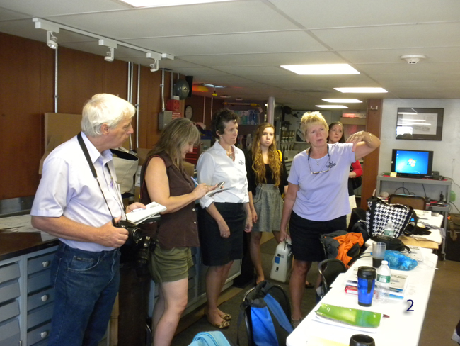
NYSG Coastal Education Specialist Helen Domske (pictured in a light purple shirt, above, [2]), organizer and leader of this week-long teacher training, provided a tour of the R/V Guardian to local media as well as NYSG's Bunting-Howarth (pictured in white dress shirt and black skirt, above, [2]), who was visiting from Cornell University. Also checking out the research vessel's facilities were Oswego County Today reporter Steve Yablonski (pictured with camera at far left, above, [2]) and Oswego's The Palladium Times reporter Janet Rebeor (pictured in brown shirt at left, above, [2]). Both reporters filed stories about this on-the-lake experience, which were added to other ones published between the last port stop (in Clayton, NY, located in the northeastern-most reaches of Lake Ontario) and this one in the southeastern portion of the basin:
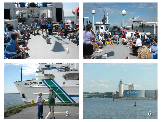
Seated in a circle on the upper deck of the ship (as seen above, [3-4]), each of the educators shared with media, legislators and other guests about the take away from their experience.
During the 'sharing session,' each teacher expressed a different aspect of the week-long adventure that meant the most to them. While some talked about a new confidence to elicit better quality interest from students about science and scientific methods, one teacher talked about emulating the experiments using available, recycled products available to her students. Still others talked about teaching students the effects of their own actions on the environment, and what the environment could mean to students as lifelong learners.
"Even though my kids are 9 and 10 years old, they really care about
their environment and they live next to a Great Lake and the Oswego
River," said Colleen Warner, a fourth grade teacher in the
Fulton City School District. "So, like most of you, I'm hoping to pay
back not just one side of the argument, but several facts so that the
kids can really make good decisions and become thinkers about their
environment and decisions they make."
Kim Linkinhoker, a Cicero-North Syracuse teacher, said "My students study both biology and environmental freshwater resources. Our water is such a valuable resource and we need to learn how to protect it."
"It will be a great way to get them thinking about careers in environmental science," said Lisa Wischerath, of the Holley Central School District. Wischerath noted that sharing her methods and working within the diverse group aboard Lake Guardian has provided a greater ability for her to teach her own students. "Just hearing what other environmental science teachers are doing in their class is really inspiring me to try some new things in mine as well," she said.
Scott Krebbeks, a Honeoye Falls-Lima middle school science teacher, said that trying to sum up the trip in one statement was difficult. "The one common thing that's really been impressed upon me is the people at each one of the places we've visited who have really dedicated their lives to monitoring the environment, monitoring water quality, studying these ecosystems," he said. "It's my hope that I can take from this some things back to my classroom that will really get the kids interested and hopefully let them see that they can maybe choose a career in the environmental sciences."
Also while at Oswego's port (as seen above, [6]), SUNY ESF researcher Dr. Greg Boyer (pictured in a green shirt, above, [5]) explained his role while on-board the R/V Guardian to reporters, including Oswego County Today's Yablonski (also pictured above, [5]). “[NYSG's] Helen [Domske] runs the educational aspects and I run the scientifict aspect,” he said. “This isn’t data that’s just going to sit in a folder somewhere. We’re actually collecting samples that are actually going to be used. It’s part of a five-year rotation. Last year we did Huron; this year we’re doing Ontario.” The research data shows variations from year to year. It is being collected in each lake on a five-year cycle to make the charts a bit easier to read and the changes show up better, he noted. “That’s why it’s really important to come back and do these things over again,” he said.
A Visit to Eastern Lake Ontario’s Dunes and the Salmon River Fish Hatchery
Guided by NYSG’s Mary Penney and the Dune and Salmon River Stewards
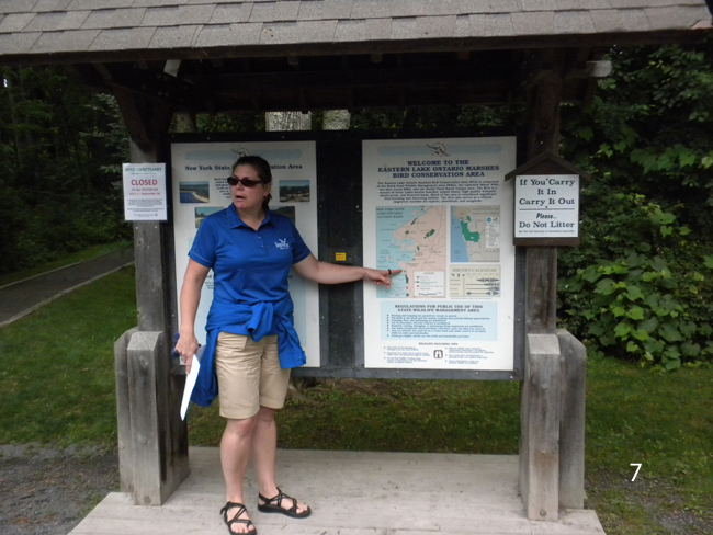
As explained to the educators during a tour conducted by NYSG Coastal Community Development Specialist Mary Penney (pictured below, [7]), along Lake Ontario’s Eastern shore lies a 17-mile stretch of sand dunes, wetlands, woodlands, ponds and creeks known as the Eastern Lake Ontario Dunes and Wetlands Area. Reaching from the mouth of the Salmon River north to the outlet of Black Pond, the area supports a diversity of plants and wildlife. It is a region comprised of a mosaic of Great Lakes barrier beaches, inland dunes, wetlands, shrub/scrub and forested lands. Much of the area is considered significant bird breeding and wintering habitat. It also serves as a critical migratory corridor for raptors, shorebirds and songbirds.
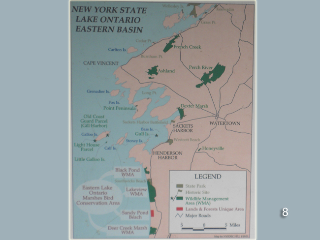
Seven properties spanning a total of seven miles long are open to the
public for outdoor recreation (pictured in the map below, [8]):
El Dorado
Nature Preserve - these thick, shady swamps provide food and cover for breeding birds such as Wood Duck, Red-shouldered Hawk, American Redstart and Green Heron, as well as flocks of warblers during migration
Black Pond Wildlife Management Area
(WMA) - where the educators toured, which allows for walking through a dune succession area.
Southwick Beach State Park and Lakeview WMA - Muskrats help shape the deep emergent marsh habitat by eating large quantities of cattail roots. The state Endangered Black Tern builds a flimsy nest on lily pads in hidden mucky openings.
Sandy Pond Beach Unique Natural Area - Between Lakeview WMA and here, Northern Pike and other fish find the shallow emergent marsh habitat critical for spawning. Leopard frogs breed here as well, then migrate to drier lands in the summer.
Sandy Island Beach State Park - Between Sandy Pond Beach's Unique Natural Area and State Park, aquatic vegetation in open water provides food and cover for bass, bullhead and yellow perch. Snapping and painted turtles also live in these waters.
Deer Creek WMA - Between Sandy Island Beach State Park and here, many amphibians and reptiles, including the spotted turtle, breed in the rare coastal fens.
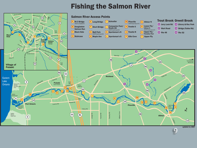
NYSG’s “Fishing on the Salmon River” map (pdf) outlines all of the access points (pictured in the map below, [9]) where anglers can fish along the river, which, along with the area's other tributaries, feeds out from eastern Lake Ontario.
This year, the summer steward program coordinated by NYSG's Penney (pictured below, [10], with several of 2013's stewards), expands from Jefferson and Oswego counties to include waterfront sites
in Madison, Oneida, Onondaga, and Wayne counties.
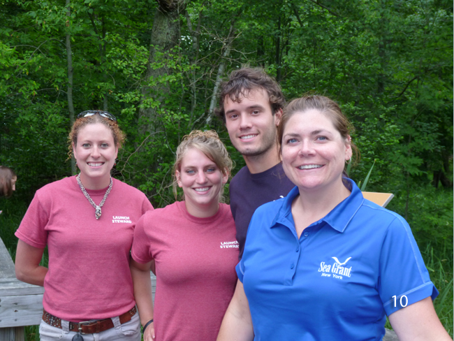
NYSG's Launch Steward program, which informs the public about the Lake
Ontario and Oneida Lake and inland rivers environment. is focused on
offering voluntary watercraft inspection education to motorized and
non-motorized boaters at 15 launch sites. For more, see NYSG's "Coastal Community Development Program" resource site, www.nyseagrant.org/ccd. There's also a news release announcing this year's stewards, "NY Sea Grant Waterfront Launch Steward Program Expanding for 2013."
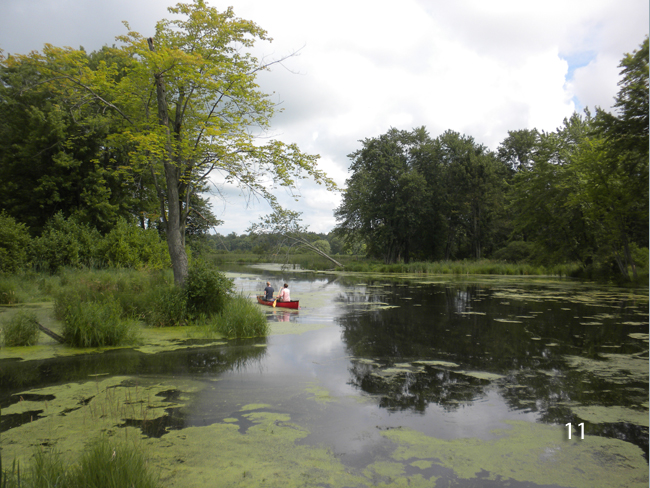
The dunes at Black Pond MWA help to create the "backdune wetlands" (pictured above, [11], and detailed in the interpretive panel below, [12]), a vast low-lying area with a variety of wetland habitats, each with its specialized plants that create habitat for a particular suite of animals. As Penney pointed out, the concentration of different high-quality habitats found here produces one of the richest biological areas in New York State.
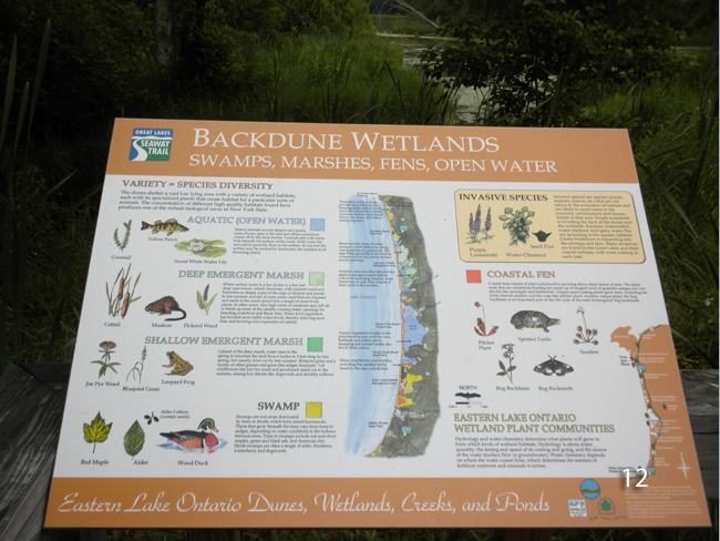
The "backdune wetlands" is a combination of shallow and deep emergent marshes, swamps (wet areas dominated by trees or shrubs which form raised hammocks), coastal fens (plant communities growing above deep basins of peat) and open waters (eg., streams and ponds). This region is vital for storing and releasing water when needed. "It's like a sponge, so it gives the water somewhere to go," said Penney.
In addition to being home many native plants, animals and insects, the area also has its share of invasive species that are not native to the ecosystem and are likely to cause harm to its economy, environment and human health. Purple loosestrife is invading the back of the dunes and the wetlands (although biological control, such as via releasing loosestrife-eating beetles and weevils, has helped). Eurasian watermilfoil, water chestnut and spiny waterflea are spreading in the aquatic habitats. Glossy buckthorn is expanding into the swamps and fens.
For more on
NYSG's partner efforts to help control the spread of water chestnut, see
"Water Chestnut Control: Start Early and Continue," a related Summer
2013 news item. Additional ways recreational boaters and others can help curtail the spread of aquatic hitchhikers are detailed in a fact sheet and article series written by NYSG's Launch Stewards since 2012. These can be found in the "Publications" section of NYSG's CCD resource Web site.
Also, see NYSG's eight-page fact sheet, "Invasive Species of Lakes Erie and Ontario" (pdf). Additional information on invasive species can be found at www.nyseagrant.org/ais.
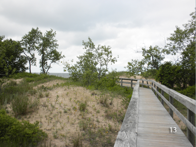
Having passed through the "backdune" area — which, in some areas, have grown and been stable for over a century, supporting a forest including red oak and sugar maple — the educators continued on the designated boardwalk to observe other sections of this environment: interior dune, swale, foredune and, eventually, eastern Lake Ontario's beach (detailed in the interpretive panel below, [14]). The interior dunes support maturing cottonwoods, various shrubs, grasses and wildflowers. It's common to find poison ivy and wild grape in the swale, or low area between the dunes. Right before the beach, in the foredune area, is where extremes of temperature, moisture, wind and sand abrasion allow for growth of just a few pioneer plants on the dunes, especially beachgrass (pictured above, [13]), wormwood and eastern cottonwood seedlings.
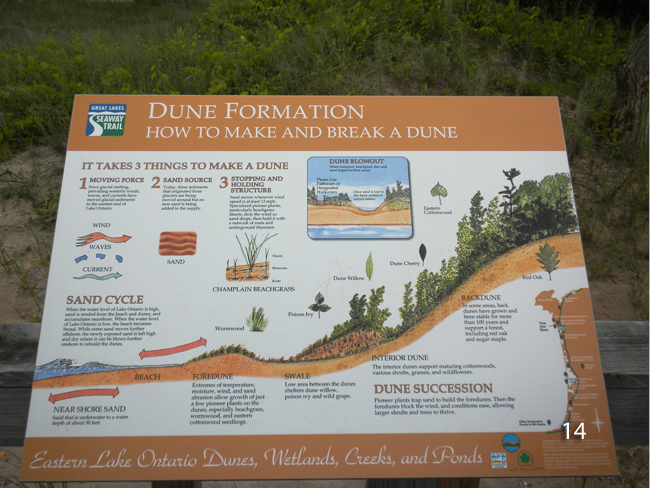
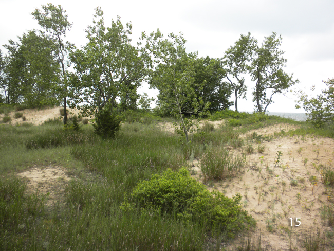
The beachgrass found in this region's foredune area is of the Champlain variety (pictured below, [15]). It's native, preferred for dune restoration and is much smaller than American beachgrass, a more robust, introduced species that flowers around Memorial Day versus around the Champlain's July 4th date.
There's a reason why people are encouraged to stay on boardwalks and kept off dune areas by beach fencing: Just 25 round-trips can reduce vegetation by 50% in an area. And, with wind of 15-25 miles/hour, if there's nothing to stop the sand, it will kick-start a dune blowout process that threatens the integrity of the entire dune system. "Once sand is gone from circulation, it's gone," reminds Penney. "The dunes here are of global significance because they are part of the Great Lakes freshwater dunes system, which is the largest collection of its kind in the world."
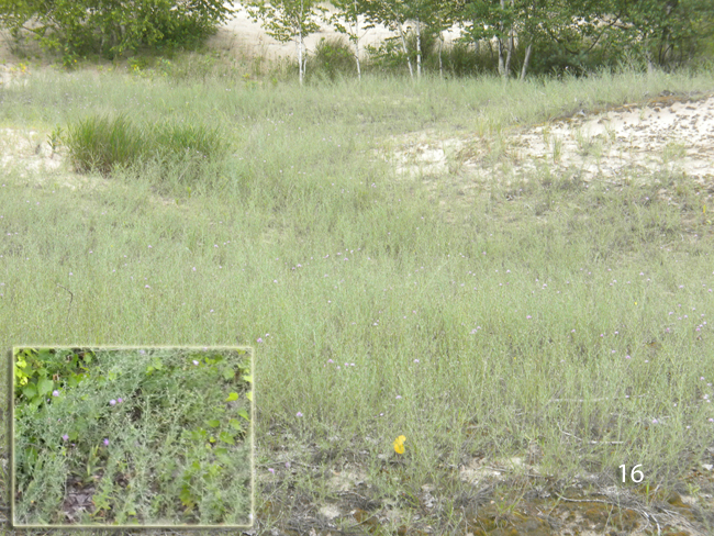
Spotted napweed, an invasive (pictured above, [16]), blooms purple flowers (pictured in inset, above, [16]). Sand cherry (pictured below, [17]) is a rare shrub that belongs to the beachgrass community. For more on the area's plants and animals, check out NYSG's "Great Lakes Sand Dunes and Wetlands" resource Web site as well as the related Eastern Lake Ontario Dunes and Wetlands guide.

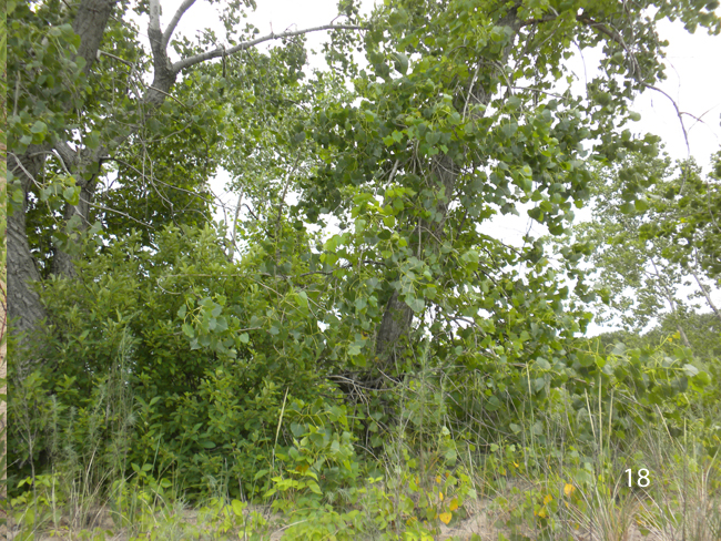
Cottonwood (pictured above, [18]) is a hydro-phillic and hypo-allergenic tree that releases cotton around June.
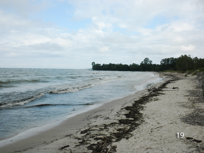
Eastern Lake Ontario's shoreline (pictured above, [19]) is littered with the shells of invasive zebra and quagga mussels (pictured below, [20]). While the activities of these omnipresent filter-feeders throughout the Great Lakes system
have helped to increase Lake water clarity, that in itself has
introduced more concerns. For example, clearer water allows more light
to penetrate, which in turn makes it more conducive for algae, especially in warmer temperatures.
Again, additional information on invasive species can be found at www.nyseagrant.org/ais.
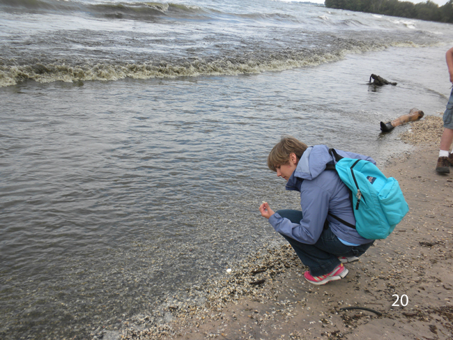
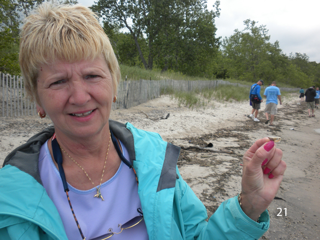
NYSG's Domske (pictured below, [21]) holds up a quagga mussel shell, which, unlike zebra mussel shells, are flat and do not curl around.
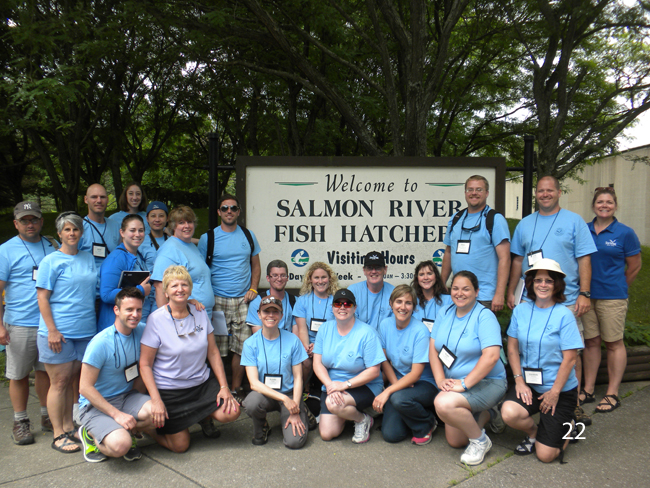
After experiencing a portion of the eastern Lake Ontario dunes, Penney and her Launch stewards traveled with the educators from the EPA R/V Lake Guardian to the Salmon River Fish Hatchery (pictured below, [22]). Located in Altmar, NY, this New York State Department of Environmental Conservation-managed hatchery serves an 11-county area and supplies fish for more than 100 public waters including the Salmon River and Lake Ontario. Each year, the hatchery stocks over 4.6 million trout and salmon, and 9 million walleye fry.
“The hatchery opened in 1981 and, at the time, was the most modern of
its kind in all of North America for raising Pacific salmon,” said
Salmon River Program Coordinator Fran Verdoliva (pictured below, [23]).
The hatchery collects eggs from adult salmon and trout, hatches them,
raises the fish, and distributes them throughout New York's Great lakes
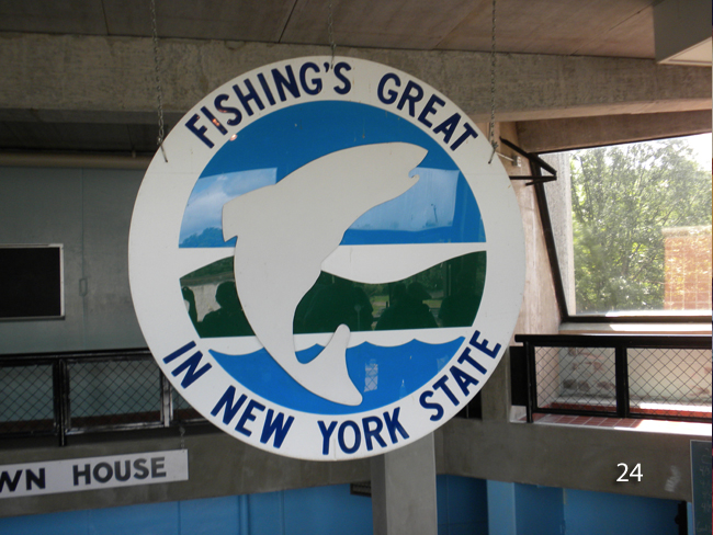
and the rest of New York State. A sign from one of the spawning houses is pictured below, [24].
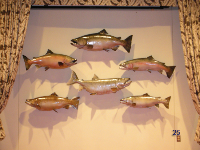
Some mounts (pictured below, [25]) of considerably large sportfish catches of the day (clockwise, from top): Chinook salmon (47 lbs 13 oz, a NYS and Great Lakes record), steelhead (rainbow) trout (31 lbs 3 oz, a NYS record), Atlantic salmon (24 lbs 13 oz, a NYS record), brown trout (33 lbs 2 oz, a NYS record), Coho salmon (33 lbs 7 oz, a NYS and world record) and (in the center) lake trout (41 lbs 8 oz, a NYS record).
Following the tour of the Salmon River Fish Hatchery, the educators returned to the port of Oswego, where the R/V Guardian was docked. They'll head back out onto Lake Ontario to do some more water and soil sampling, including in some of the Lake's deepest spots. More on that in the next blog post.
|