Before, during and after landfall of Sandy in late October, NYSG-funded Stony Brook University (SBU) School of Marine and Atmospheric Sciences researchers kept close tabs on the storm.
SBU Storm Surge Research Group members
Drs. Malcolm Bowman and
Brian Colle provided their results via E-mail, the Group’s Web site, and NYSG’s Web site. During the height of the storm, NYSG’s Twitter and Facebook feeds were the primary avenues for providing information as many (including the University) lost power and network connections. In some cases, the group was able to correct some of the storm-related inaccuracies reported about coastal flooding in lower Manhattan.
Once Sandy retreated, NYSG Coastal Processes and Facilities Specialist
Jay Tanski surveyed many of the areas hit hardest on Long Island’s South Shore. His report is featured at
www.nyseagrant.org/hurricane. This site also includes an array of pre- and post-storm resources, including educational materials and volunteer opportunities.
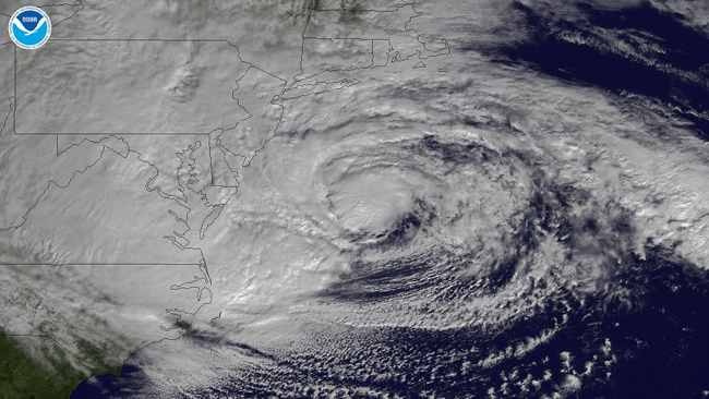
A National Oceanic and Atmospheric Administration (NOAA) GOES-13 satellite-produced image of Sandy descending on the U.S. Northeast on Monday, October 29, 2012. This image shows the storm as it is centered off of Maryland and Virginia, is heading in a northwestern direction towards the Delaware and southern New Jersey coasts.
– Paul C. Focazio